
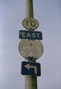
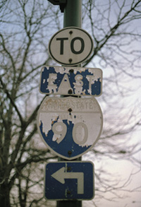
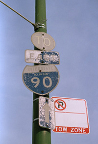
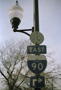
The four signs below are located in Lawndale and all refer to the Homan avenue entrance to the Eisenhower expressway. Two of them are on Douglas boulevard, one on Jackson boulevard, and one on Homan itself. There many, many more scattered throughout the west side that we have not yet found or photographed. There are also some old I-94 signs out there, referring to the Kenndedy Expressway. We’d have more on this page, but if you’ve seen a couple, you’ve seen them all. At face value, they are ordinary interstate shields, maybe a bit worse for wear. However, they are remnants of a simpler time in Chicago’s history, before expressway numbering made any sense.
The first expressways to open in the Chicagoland area were the Edens on the Northwest side, and the Calumet in the far south. These were less trouble to build as they mostly cut through yet undeveloped swaths of land. The first inner-city expressway built was the Congress, now Eisenhower expressway, named originally because it starts at and continues (roughly) along Congress Street. The first section opened in 1955, a real product of its time. Infrastructure was cleared for a full block beginning downtown all the way through Oak Park, something which would never, ever happen in modern times. Arguably, the manner in which this expressway was built is one of a number of reasons that antequated signs remain today in neighborhoods surrounding it.
Politics aside, the Eisenhower was signed as I-90 from its beginning. In order to link it with the Northwest tollway, I-90 was routed north along I-294, the Tri-State tollway, from the Hillside interchage until the Rosemont interchange, where the Northwest tollway begins. Counterintuitve at worst, right? This is where it gets confusing. The two in I-294 indicates that it is a beltway, ideally, that it deviates from I-94 and reconnects with it at another point beyond the inner city. The Calumet expressway, which ran south from the city beginning at 103rd and Stony Island, was signed as I-90. It connected with I-294 and I-80 in Lansing where it went east along I-80. West of the Calumet, I-294 ran along I-80 until it broke off and became the Tri-State tollway. At no point does I-294 actually merge back with I-94. It merges with I-80 and I-90, runs east signed I-80/90 and eventually meets up with I-94 in Gary.
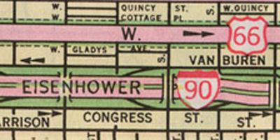
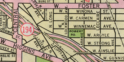
This confusion may be attributed to the fact that there were no interstate routes running through the city, linking all of these routes properly. However, even after the Kennedy and Dan Ryan expressways were built, incongruity was furthered. The Dan Ryan was signed as I-90/94, as it is currently. The Skyway was signed as I-94, and the Calumet as I-90 – today they are reversed. The Northwest expressway, which was soon renamed for the late President Kennedy, was signed as I-94 until the Edens expressway which carries I-94 north. After this split, the Kennedy was signed IL-194 for the short period until the Rosemont interchange, with IL-194 continuing as a spur into O’Hare.
Essentially, the routing of I-90 was the source of confusion. This changed in 1973 when the interstates were re-signed with their current alignments. The Kennedy became I-90/94, the O’Hare spur became I-190, the Calumet expressway and Skyway were switched, finally connecting I-94 with I-294. The Eisenhower became I-290, except on a number of interstate shields, lying in wait, hoping to confuse you if you don’t know where you’re going.
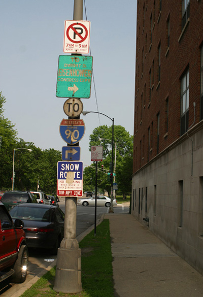
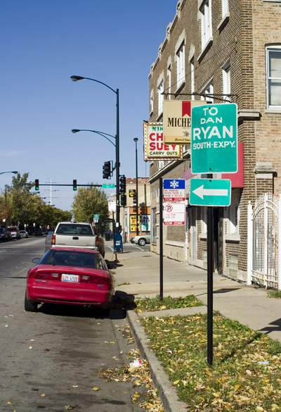
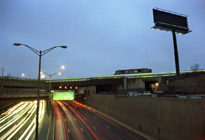
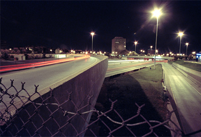
These signs are quite rare. We only know of three still standing, two of which are shown here. Not shown is a second Dan Ryan sign about a mile away from the one at right. The Eisenhower sign has probably been up since the expressway was built between 1955-60; the Ryan signs are newer. These signs refer to expressways by name, which some may find helpful and less confusing. After all, Chicagoans refer to the expressways colloquially by name, not number.
 Tom’s Trolley Bus Pictures
Seligman, Amanda I. Block By Block: Neighborhoods and Public Policy on Chicago’s West Side. Chicago: University of Chicago Press, 2005.
- Expressway Parks
- Yellow Street Signs
- Long Lost Loop Lanes
- Slow! Watch for Politicians
- East Side Trust & Savings Bank


