That Not-So-Great Street: State Street in Transition
by Patrick Steffes
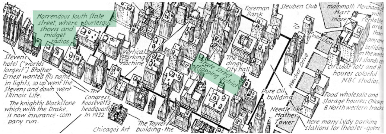
Architectural Forum, 1933; highlights added by author
Fully 58 years before the Harold Washington Library Center was dedicated on October 4, 1991, the southern end of Chicago’s famed State Street shopping district was described in a 1933 edition of a national magazine as “horrendous” and teeming with “burlesque shows and midget radios”.
The battle between 1975 and 1991 to design, build, and open a new central Chicago Public Library is closely linked to the decades-long decline in the southern end of Chicago’s famed State Street shopping district, and the seemingly endless efforts to eradicate the more sordid portions of this internationally known retail destination. While a lively shopping, educational and residential neighborhood today, the area of South State Street around Congress Parkway was for decades seemingly stuck in a state of perpetual decline.
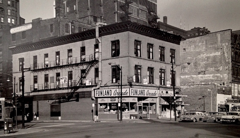
Northwest corner of Harrison St. and South State St., 10/26/63, Sigmund J. Osty visual materials (Chicago History Museum), box 2
Typical of the type of businesses on State Street south of Van Buren Street for decades was on the northwest corner of State and Harrison, seen above. Home to both the Funland Arcade (“Art Movies and “Art Books”) and Rialto Burlesque (“Girls Girls Girls”), behind it may be seen some of the extant buildings on South Plymouth Court, including one with a Linotype sign at top left.
With the Harold Washington Library Center turning 25 years old in 2016, Forgotten Chicago thought it an appropriate time to look at the long quest to reinvigorate South State Street, and the long and complicated saga of how the largest municipal library in the United States ended up in the midst of what had once been one of the most notorious urban sections in the Midwest. We hope you enjoy this look at the tremendous changes to South State Street, featuring images unseen in decades, with many that have never before been published online.
The second part of this article may be seen here, and describes the long journey to build what would ultimately become the Harold Washington Library Center.
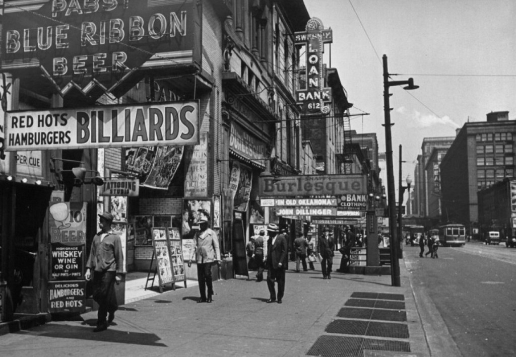
Calumet412, 1944
In the above image dated from 1944, the west side of the 600 block of South State Street (two blocks south of the future site of the Harold Washington Library Center) features most of the seamier sides of urban life conveniently located in one block: burlesque, “high grade whiskey wine or gin”, tattoos, billiards (with illegal gambling?), and access to loans to pay for it all, presumably in the form of pawn shops. Seen in the images above and below is the still-extant Harrison Street entrance to the subway, underneath the burlesque sign.
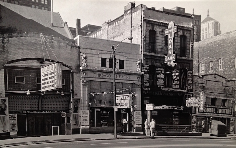
South State St. at Harrison St., 1962, Sigmund J. Osty visual materials (Chicago History Museum), box 2
Virtually unchanged 18 years later, in 1962 the former Chicago Theatre was perhaps the dirty little cousin to the other Chicago Theatre about a mile to the north. Ironically, this one-time theatre building was at the time home to a Publix Cafeteria, with the Gayety and grandly named National Theatre both within easy stumbling distance.
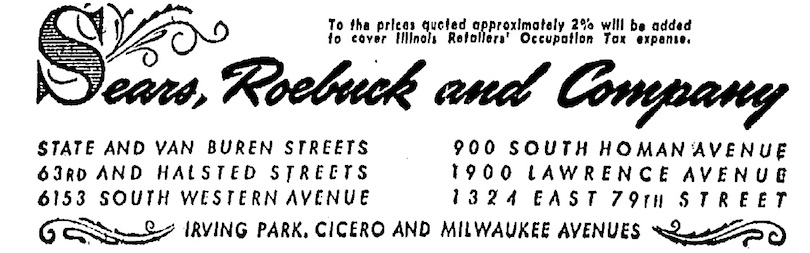
Chicago Tribune, 1944
The near-comical prevalence of vice along South State Street was no laughing matter to Chicago’s civic and business leaders and retailers. Sears, Roebuck & Company, at its peak arguably the highest-profile, most influential and most successful company ever based in Chicago, was by far the largest department store chain in the country by the 1920s, and the second largest retailer in the U.S., trailing only grocer A&P.1 By 1963, Sears, Roebuck would be the world’s largest retailer,2 with its flagship store from 1932 to 1983 seen just two blocks north and right in the image above.
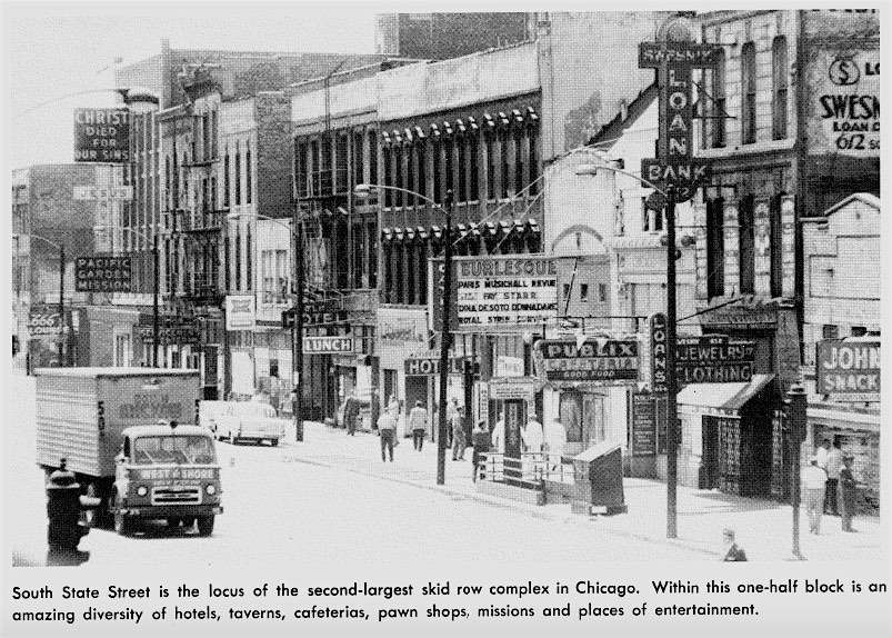
The Homeless Man on Skid Row, 1961
In an image published in 1961, nearly thirty years after the map describing South State Street as “horrendous” was published, the 600 block of South State’s “amazing diversity” of burlesque houses, low-rent hotels, and cafeterias were all going strong, as seen in this photograph taken from a City of Chicago Tenants Relocation Bureau publication.
Shown above is also the west side of the 600 block of South State, the same block as seen in the earlier image from 1944. In 2016 this entire block is the home of William Jones College Preparatory High School. The Pacific Garden Mission and its distinctive “Jesus Saves” neon sign above far left was relocated to the 1400 block of South Canal Street in 2007 for an expansion of Jones College Prep, completed in 2013.
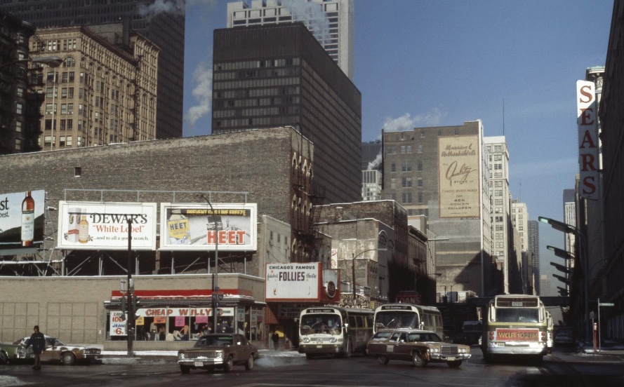
C. William Brubaker Collection, University of Illinois at Chicago, 1978
At what would ultimately become the site of the Harold Washington Library Center on the 400 block of South State, little had changed for decades, as shown above in 1978. At that time, this side of the block featured two billboards advertising liquor, a burlesque theater, and a store at the northwest corner of Congress Parkway named “Cheap Willy’s”. Congress Parkway, the eastern end of the Eisenhower Expressway (I-290) was the main western gateway into central Chicago, and would carry tens of thousands of vehicles daily into the Loop, to Michigan Avenue, Chicago’s lakefront, and Lake Shore Drive.
State Street Responds to Outlying and Suburban Retail Competition, 1952-1979
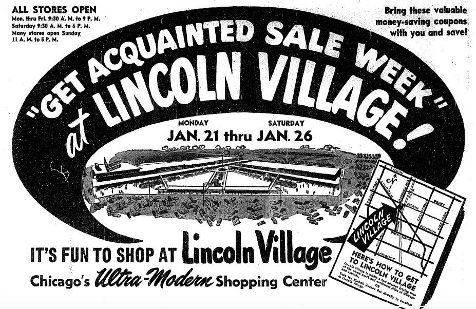
Chicago Tribune, 1952
The dominance of State Street and Chicago neighborhood shopping districts in regional retail sales was unchallenged for decades, but new competition and rapidly growing suburbs and outlying Chicago neighborhoods would bring major changes after World War II. The grand opening in January 1952 of Lincoln Village, at the intersection of Lincoln Avenue and McCormick Boulevard in Chicago near the Lincolnwood border would begin a major shift in the retail landscape of the Chicago region. Designed by prolific retail architect Sidney Morris & Associates, Lincoln Village was the first of dozens of neighborhood and regional auto-oriented shopping centers to open in Chicago and its suburbs over the next 60 years.
Unlike several other pioneering auto-oriented city and suburban shopping centers like Evergreen Plaza (below), Lincoln Village continues to operate in 2016, and is well worth a visit for fans of overlooked landmarks of Chicagoland history and development. For an in-depth look at the history of Lincoln Village, visit this interesting link.
Honeywell Customized Temperature Control Ad, Architectural Record, 1953
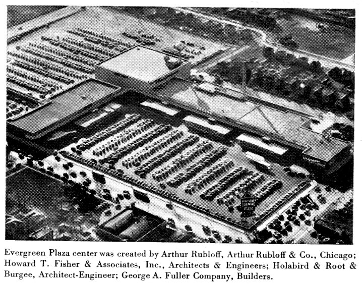
In August 1952, just seven months after Lincoln Village opened, Evergreen Plaza, designed by Howard T. Fisher & Associates and Holabird & Root & Burgee, would open at West 95th Street and South Western Avenue in Evergreen Park. Briefly the largest shopping center in the Midwest until Northland Center in Southfield, Michigan opened in 1954, the mall portion of Evergreen Plaza closed in May 2013 and was demolished starting in October 2015.
Although outlying shopping centers would ultimately siphon hundreds of millions of dollars annually in retail sales from State Street and other neighborhood shopping districts, Chicago’s pioneering early shopping centers are often overlooked in the history of the Chicago region. Projects like Lincoln Village and Evergreen Plaza had an enormous impact on Chicagoland development, economics, and infrastructure.
Top: Chicago Tribune, 1958 Bottom: JaNae Contag, 2013
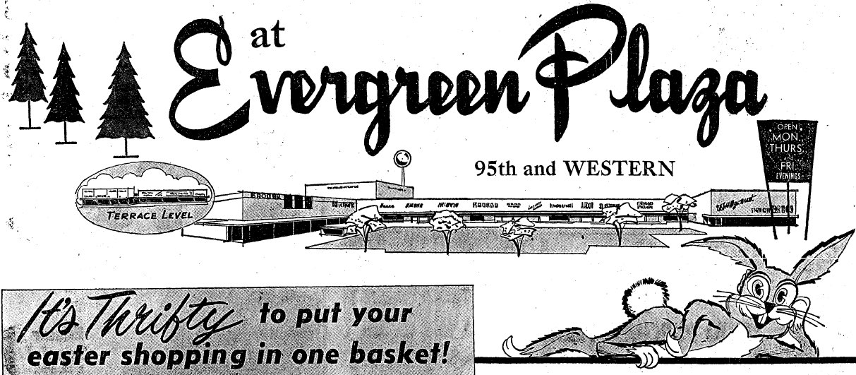
Recognizing Evergreen Plaza’s enormous historical significance, Forgotten Chicago made a concerted effort to rescue as much of Evergreen Plaza’s vast archives as possible. Following its closure in May 2013, we removed dozens of boxes full of thousands of pages of blueprints, business records, marketing material and ephemera from Evergreen Plaza that were left behind in the basements of this once-iconic regional shopping center.
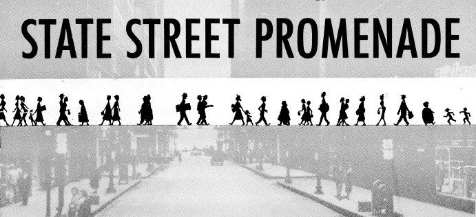
Make No Little Plans for State Street Part I: The State Street Promenade
State Street Promenade, Chicago Plan Commission, 1953
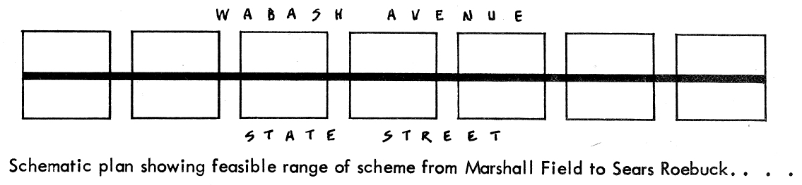
In 1953, the year after Lincoln Village and Evergreen Plaza opened, the Chicago Plan Commission prepared a forgotten scheme that advocated building a nearly mile-long second-level skyway, the State Street Promenade, to connect all of the buildings on the east side of State Street from Randolph (150 North) to Congress (500 South). This expensive, complicated, and unrealized plan may have been prepared as a response to the outlying shopping centers that had recently opened or were in the planning stages.
Architectural Forum, 1951
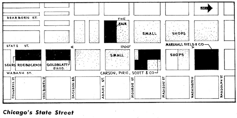
A more detailed map of State Street in the early 1950s was published, ironically, in an article describing the planning for the massive new Old Orchard shopping center in North Suburban Skokie, announced in 1950. Sponsored by Marshall Field & Company, Old Orchard would open in 1956, the biggest competition up to that time for the dollars of well-heeled North Shore shoppers, and an enormous success that continues to thrive as of this writing. Note that the above map was published before the completion of the Congress / Eisenhower Expressway that would dramatically change the layout of the South Loop in the years ahead.
State Street Promenade, Chicago Plan Commission, 1953
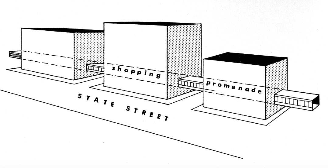
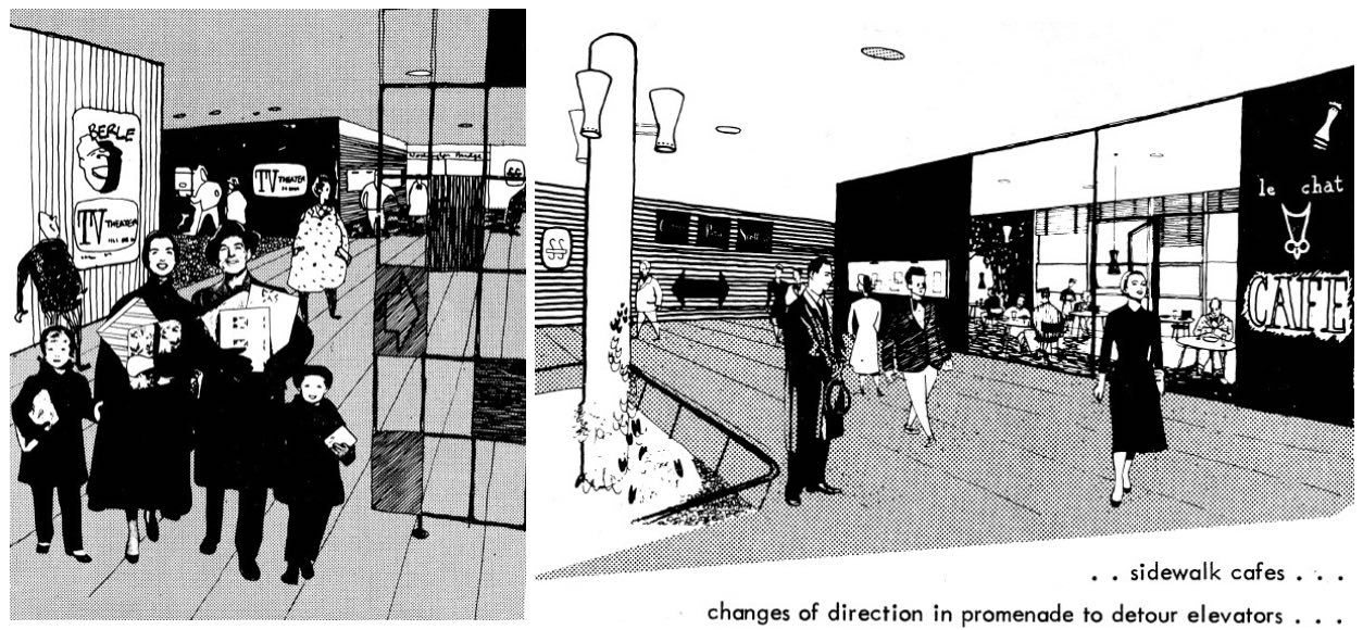
Published 25 years before construction began on the ill-fated State Street Mall, the State Street Promenade was oddly presented in renderings as a destination for both families above left and single women attracting the attention of well-dressed men above right. Depicted as an up-to-the-minute shopping destination circa 1953, renderings depicted a “TV Theater” showing episodes of Milton Berle and Le Chat, presumably a cat-themed café. Note the second floor indoor “Promenade” entrance to Carson Pirie Scott showing their iconic three-part logo, depicted above center.
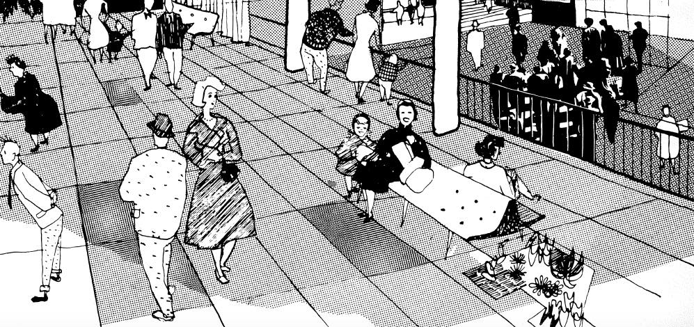
State Street Promenade, Chicago Plan Commission, 1953
Had the State Street Promenade been constructed, it would have profoundly changed retail and commercial real estate in the eastern part of the Loop. This plan would have also greatly diminished State Street’s greatest asset – the enormous numbers of street-level pedestrians and bustling street life that State Street was justifiably famous for, and the dream of every commercial real estate leasing agent today.
Inland Architect, 1968
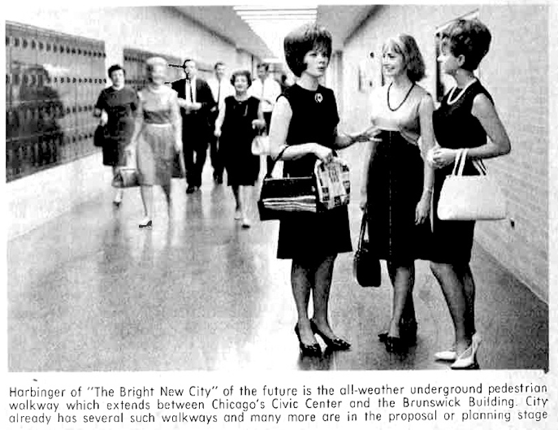
The State Street Promenade apparently did not make it past the planning stage, and this scheme is not known to have been covered online or in any books or magazines on Chicago history until the publication of this article. While a limited number of skyways were constructed in and near the Chicago Loop, Chicago’s Pedway system is the modern successor of the State Street Promenade.
The first sections of Chicago’s modern Pedway connecting commercial and civic buildings opened by January 1966,3 centered around the former Brunswick Building at 69 West Washington. The Pedway has been greatly expanded in the ensuing 50 years.
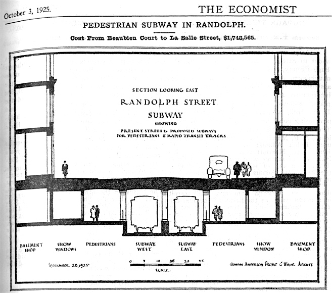
The Economist, 1925
When Chicago’s modern Pedway system opened starting in the mid-1960s, it had been a civic improvement considered for at least 40 years. In the above 1925 scheme, leading local firm Graham, Anderson, Probst & White proposed a “Pedestrian Subway” under Randolph between LaSalle on the west and Beaubien Court and the Illinois Central railroad terminal on the east, with room for a future subway line, as seen above. The accompanying article noted the public safety benefit of such a scheme and that “Pedestrians would not be in imminent peril of being killed by some careless chauffeur as they are at the present time.”
Make No Little Plans for State Street Part II: The State Street Mall
C. William Brubaker Collection, University of Illinois at Chicago, 1979
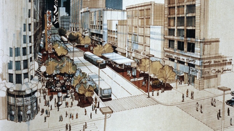
Beginning at 9:30 a.m. CDT on Saturday, June 17, 1978, State Street would undergo its most radical change to date as traffic was banned for private vehicles along State Street from Congress Parkway to Wacker Drive in advance of construction of the State Street Mall.4 Shown above and below is a rendering of South State Street at the intersection of Madison Street, with the iconic Carson Pirie Scott store visible in images above and below at left.
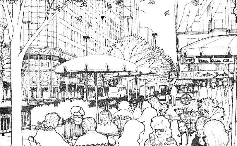
Inland Architect, 1979
Despite renderings showing a lively mix with throngs of pedestrians and outdoor dining and food carts, the State Street Mall before it was demolished and the street reopened to traffic in November 1996 did not live up to its promise in revitalizing State Street, including the section where the Harold Washington Library Center would ultimately be built between Van Buren and Congress.
The demise of the State Street Mall is long and complicated. For insight by The Chicago Tribune upon its reopening to public vehicular traffic, visit here. The New York Times looked at State Street Mall prior to its de-malling here. Finally, Distinguished Professor Emeritus of Art History, Architecture & Urban Planning at the University of Illinois at Chicago Robert Bruegmann discussed on WBEZ in 2011 why the State Street Mall failed here.
The Battle Over Chicago’s New Central Library
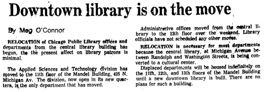
Chicago Tribune, 1975
In the mid-1970s, Chicago’s venerable central library on North Michigan Avenue between Washington and Randolph Streets was being converted to the Chicago Cultural Center, and the library began moving to the Mandel Building Warehouse at 425 North Michigan starting in August 1975.5 In the ensuing 16 years, Chicago would see no fewer than six mayors, and a tremendous amount of discussion and controversy on where to permanently locate the new central library.
The second part of this article was also published in September 2016, and may be seen here. This article examines the many proposed plans of what would ulimately become the Harold Washington Library Center, as well as what remains of historic South State Street today.
Sources
1. Marc Levinson, The Great A&P and the Struggle for Small Business in America, (New York : Hill and Wang, 2011), pg. 113
2. Marc Levinson, The Great A&P and the Struggle for Small Business in America, (New York : Hill and Wang, 2011), pg. 257
3. First Outlet in Underground System Opened, Realty & Building, January 8, 1966, pg. 3
4. Building Begins on State Street, Realty & Building, June 24, 1978, pg. 1
5. Meg O’Connor, Downtown library is on the move, Chicago Tribune, August 28, 1975, pg. pg. N_B2
Read More
This article was last updated
on Tuesday, September 13th, 2016 at 9:31 am.


