
| Lake Shore Drive (LSD) is probably Chicago’s most famous road, and much has already been written about its colorful history. We’ll try not to retread. At the time of the great fire, LSD was a placid right of way lined with mansions. It began at Oak street and extended north to the then city limit at Fullerton avenue. Since then it has been extended north and south at varous points in time. The most notable extension was built in 1933, from Belmont to Foster avenues. Featuring clover-leaf interchanges instead of at-grade intersections, this stretch of road is Chicago’s first freeway, predating the Calumet expressway by 17 years. For the 1934 Century of Progress Fair, LSD was also extended south to Jackson Park. However, the two extensions did not connect. The viaduct that would later be known as the “S-curve” was not built until 1937. South of the river, the road was known as Leif Erickson drive until 1946, when the entire road was named Lake Shore Drive. |
|
With the exception of extensions from Foster avenue to the current northern terminus at Hollywood avenue, and improvements to the southern extension to Jackson Park in the mid-’40’s, LSD stayed essentially the same until 1975, when Wacker Drive was extended east to meet LSD at the S-curve. Then, around 1982, construction began on a re-configuration of the S-Curve. From Monroe Street to Wacker Drive, LSD was rerouted east along new fill, greatly reducing the sharpness of the curve. This section opened in 1987.
|
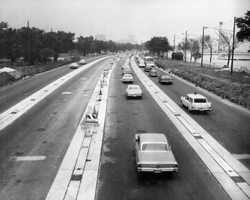
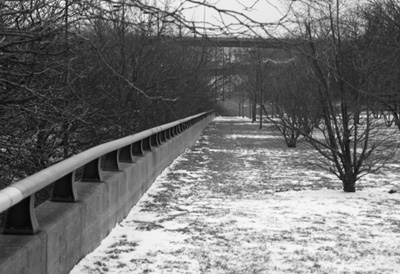
 Left: Looking south from the end of upper Wacker at the old path of LSD.
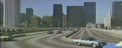
Above: The s-curve, looking west, as seen in the 1975 film Brannigan. One of the best shots of the s-curve on the big screen was in the late 1970s short film Chicago Breakdown.
Left: Looking south from the end of upper Wacker at the old path of LSD.
Above: The s-curve, looking west, as seen in the 1975 film Brannigan. One of the best shots of the s-curve on the big screen was in the late 1970s short film Chicago Breakdown.
|
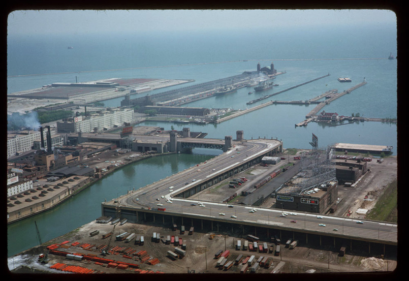
Charles Cushman, Indiana University Archives, 1963.
The definitive S-Curve photograph, taken from the Prudential building in 1963 by the venerable Charles Cushman.
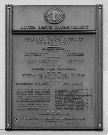
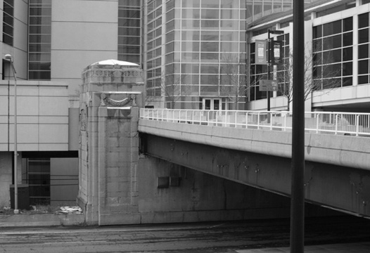
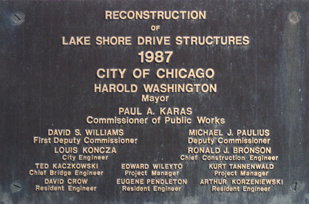 Two plaques from Lake Shore Drive. The first, right, from the initial construction of the bridge and viaduct. The second, above, from the re-configuration. Fifty years apart, both of these plaques are located on the southeast bridge house. The 1987 plaque is on the lower level connection with Wacker Drive, while the 1937 plaque is on the upper level, and is inaccessible to pedestrians. Which plaque do you like better? In other words, how much do you like Helvetica?
|
|
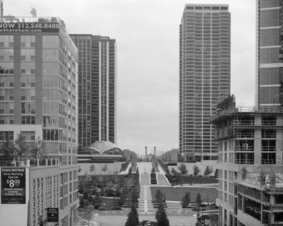
In 1988, Wacker Drive was connected to the reconfigured LSD via a new lower level of the bridge. The upper deck section of Wacker turned south using the old viaduct and connected to Randolph street (the path seen in the above left image). That was removed in 1994, soon after which a small golf course was built in the land vacated by the viaduct and long-gone railroad tracks. The golf course was removed in 2002, when construction began on a number of high-rise condos with a park in the middle, though, the golf course is still visible (as of this writing) on Google Earth.
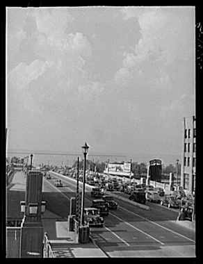
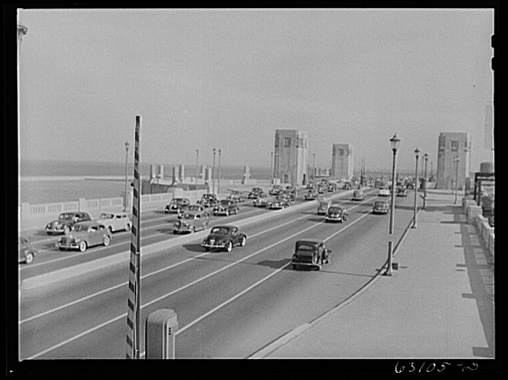 John Vachon, Library of Congress Prints and Photographs Division, Farm Security Administration – Office of War Information Photograph Collection. LC-USF34-063081-D (left), LC-USF34-063105-D (right), 1941.
Bridge over the mouth of the Chicago River, views north and south respectively, 1941.
The 23rd street viaduct was built along with the rest of Leif Erickson Drive in 1933-1934 for the Century of Progress Fair. McCormick Place, a lakeside convention center, was opened in 1960. It was located directly at the eastern terminus of the viaduct. The 23rd street viaduct then became not only an entrance to LSD, but the main access point for McCormick Place. Early in 1967, McCormick Place burned down. Studies conducted proved that the building had an incredibly insufficient water and sprinkler system. A new building was built on the same site, using the existing foundations, opening in 1971.
 Photographer unknown
 Left: Photographer unknown
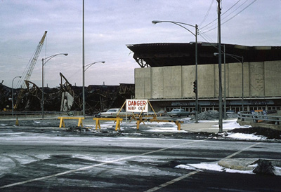
Left: The original McCormick Place after it burned, 1967.
Right: The rebuilt McCormick Place and 1997 footbridge showing the differences in uses of the viaduct, 2007.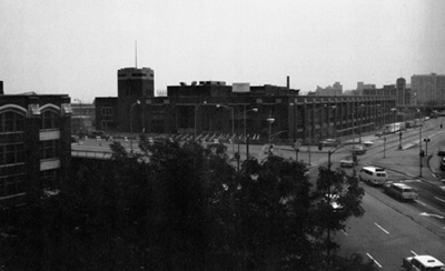
 Left: City of Chicago
Left: The intersection of King Drive and the 23rd street viaduct, circa 1974. This view is facing south, the viaduct continues east in the left of the picture. The building in the center of the image was torn down and replaced by the first addition to McCormick place. The Lake Meadows highrises can be seen in the distance. Right: 1986 McCormick Addition, 2005.
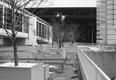
| By the mid-80’s there was a need for expansion at McCormick place. A new building was built on the opposite side of LSD in 1986, and another in 1997. More than half of the 23rd street viaduct was eliminated by the 1997 addition. Over LSD though, it still remains barely hidden. Instead of cars, the viaduct now carries pedestrian traffic over LSD from one building to another in an enclosed walkway. However, one can walk outside and directly onto the viaduct where there is some bench seating and planters. The former on and off ramps are still there as well, having been attractively landscaped.
Right: Conventioneers walking on the 23rd Street Viaduct in 1992. |
 Ron Schramm, 1992 Ron Schramm, 1992
|
Left: Looking south down the former on-ramp.
Right: The same ramp is seen on the left side of this image. Lake Shore Drive is divided by these ramps, this view looks south at the southbound lanes.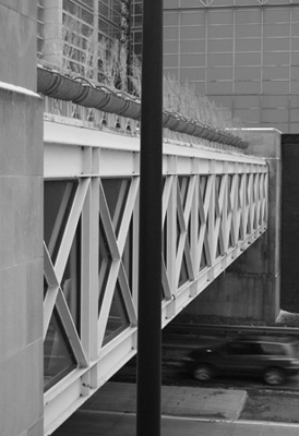
Left: View west from the north end of the viaduct.
Right: View west from the south end.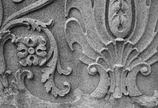
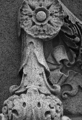
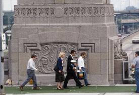
Details of ornament on the bridge house.
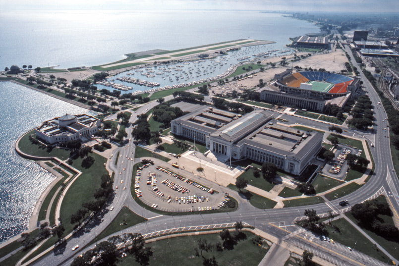
The last major reconfiguration to LSD occured in 1996. As seen above in the pre-reconfiguration image, the northbound traffic lanes were east of Solider Field and the Field Museum, the southbound lanes to the west. The lanes split off at Roosevelt Road and reconvened around 24th place, directly after the 23rd Street Viaduct’s southern on/off ramp. With the reconfiguration, all LSD traffic was placed on the western (southbound) lanes, which had additional lanes added to it. A portion of the eastern lanes were converted into an access road named Museum Campus Drive. The area between the Field Museum and the Shedd Aquarium, no longer cut off from each other, was landscaped. Also during this reconfiguration, Roosevelt Road was connected to LSD and Columbus Drive. Unfortunately, we do not yet have a good photo showing the re-configuration. It can be seen in Google Earth, of course. If you do go to GE, the imprint of a section of the old northbound lanes can be seen in the pavement in the parking lot directly north of McCormick place.
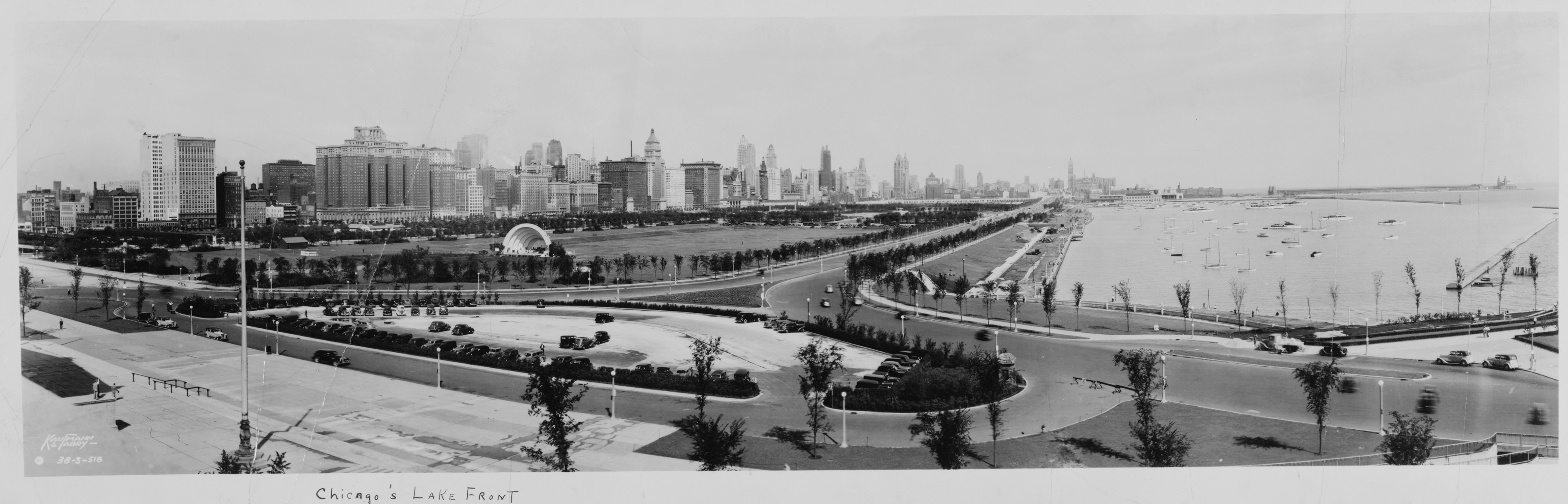 Kaufmann & Fabry, Library of Congress Prints and Photographs Division, Panoramic Photographs Collection. LC-USZ62-130969, October 10, 1938.
Lake Shore Drive, view north from the Field Museum in 1938. Click to enlarge.
- South Western Avenue Improvement
- Bridge Out For Good
- Chicago’s Shoreline Motels – South
- Long Lost Loop Lanes
- Chaddick Institute Cityfront Center Walking Tour on Saturday, June 18, 2022


